
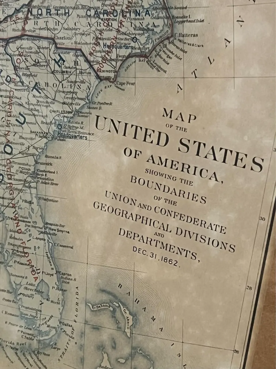
The date on the map is big enough to read through glass. December 31, 1862. Imagine a person at an estate sale reading it from across the room, then walking over because a piece of paper that was there during the Civil War is a different proposition from a piece of paper about the Civil War. The map has already done a fine job of getting them across the room.
Which Civil War map is this?
Read the small words between the big ones. This is a map of Union and Confederate geographical divisions and departments. In the photo, the names of towns along the Carolina coast sit underneath another set of names, the commands that made sense of the same land to two armies. Charleston is still Charleston. The lines of authority around it are the things that move.
The full title matches Plate CLXVI, or Plate 166, in the Atlas to Accompany the Official Records of the Union and Confederate Armies. The Texas State Archives records the atlas’s publication from 1891 to 1895. The David Rumsey collection catalogs this plate in its 1895 atlas and credits Julius Bien & Co. as lithographer. December 31, 1862 tells you where to place the map in the war. The atlas tells you where to place the design in the history of printing. Texas State Archives plate record · David Rumsey collection scan
How to date the sheet in your frame
The title identifies the design. To date the piece of paper, start at the margins. Look for the Roman plate number, the lithographer’s line, and any credit for a later publisher. Compare the layout to an archive scan. A center fold can be consistent with a sheet that lived in an atlas, while a modern reproduction can carry the same printed markings. Check the paper and the reverse when you can see them safely. The close-up of this copy gives us a legible title and date. A full view of the margins would give us more to work with.
The framed map pictured here sold on eBay. For a price comparison, look for another example with the same printing and similar condition. An unframed plate, a later reprint, or a sheet with a split down the fold is a different proposition. Listing for the pictured map
What to photograph in What’s It Worth?
Start with the whole sheet and a close-up of the title. Add the plate number and the printer’s line if they’re visible. Then ask Does this date describe the map’s subject or when my sheet was printed? Once you know what the evidence supports, compare it with listings that describe the same edition and condition. The big date got you across the room. The tiny type is what you came for.